A safer and more efficient way to inspect large wastewater tunnels
Background
The 6-million people Madrid metropolitan area has one of the largest wastewater networks in Europe. With more than 15.000km of sanitary sewers, of which more than 2.400km are large diameter, this vast infrastructure network plays a critical role in the Spanish capital´s daily life and environmental impact.
Just as in any other city, the maintenance of these tunnels is paramount to minimize water loss, prevent subsoil pollution as well as structural damages that may eventually cause a collapse. To do so, periodic inspections are required in order to:
Evaluate overall tunnel condition for early detection of problems
Identify undocumented connections and illegal spills
Accurately map the exact trace of these intricate tunnels
the problem
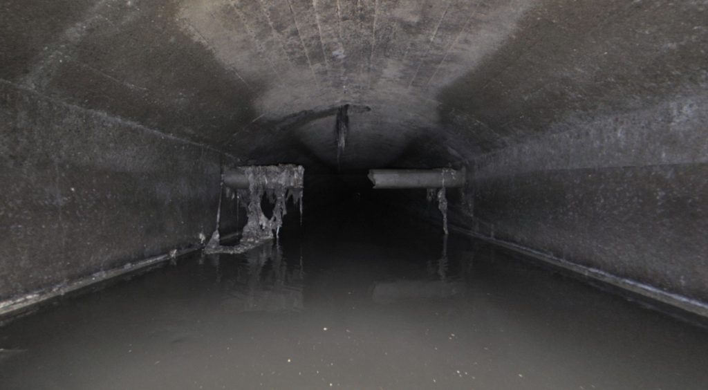
Back in the days, inspections were carried out by well cleaners under rather risky conditions. In a confined space with no light, no communication with surface, and presence of toxic gases, any small incident may have fatal consequences.
For safety reasons, labor legislation does not allow any more staff to walk across such tunnels, or when it does, it demands extreme safety measures to mitigate risks, making inspection process costly and time consuming.
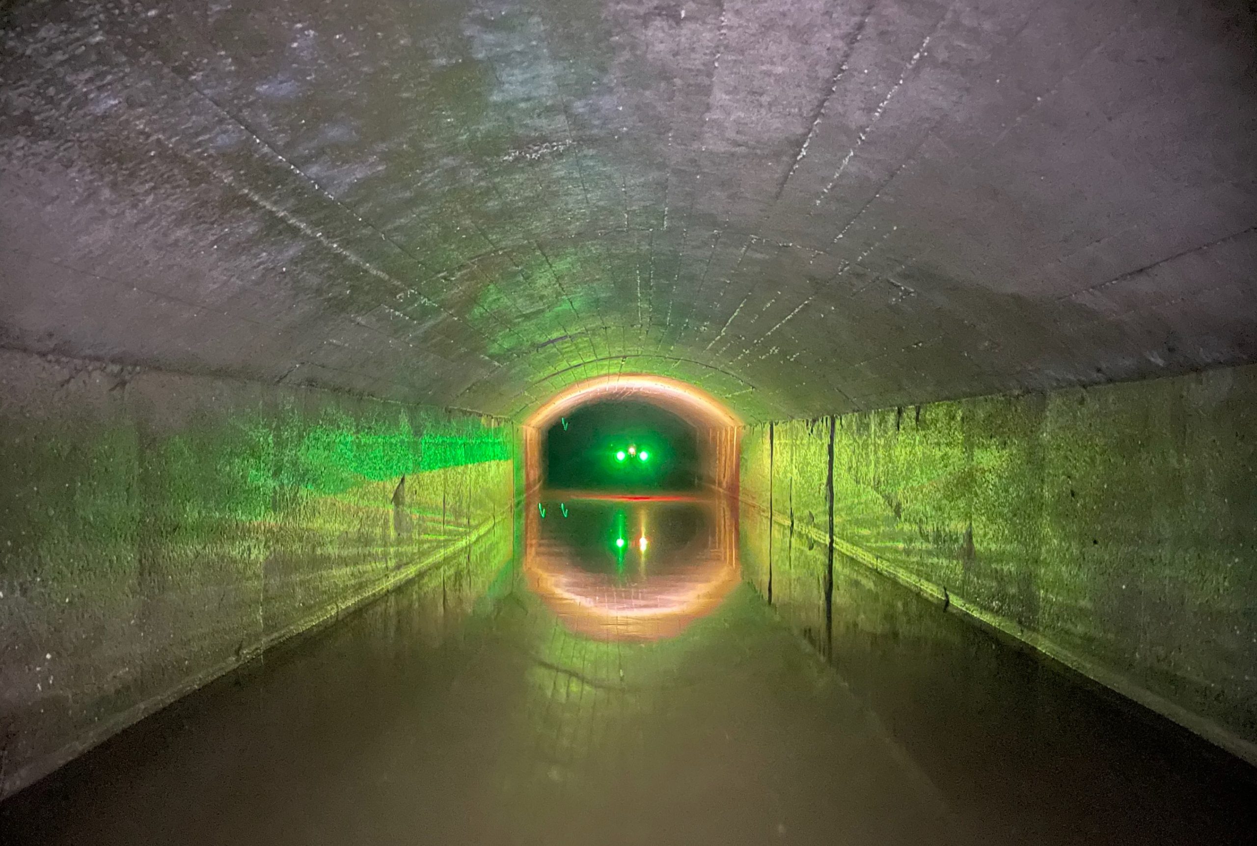
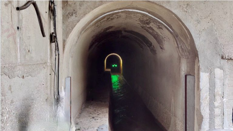
In small diameter collectors, the use of wheeled robots facilitates the job, providing live images of the interior for a few tenths of meters. However, for large diameter tunnels, these devices lack the capacity to move across deep waters, mud covered areas and surpass obstacles, leaving aerial robots -a kind of drones- as the only alternative.
Nevertheless, piloted drones are not an option as radio connection between the operator and the robot is normally lost due to several shadow areas along the path, caused mainly by the long distance and existing curves in tunnel the trace, and also stacks of fallen rock.
Therefore, an autonomous drone, able to operate with NO pilot, NO radio communication, NO GPS/GNSS and NO light is the only solution that ensures a safe and complete mapping of the tunnel.
The Solution
Canal de Isabel II, the public entity responsible for handling the entire water cycle in the region of Madrid, is a pioneer when it comes to adopting new technologies and has been the first municipality to promote the use of autonomous drones for underground inspections.
Under an innovation public tender with several cut-offs, Hovering Solutions´ technology scored significantly higher than any other alternative and was ultimately selected as the only proposal which fully met the requirements for autonomous inspection in large sewers.
With this support, along with other early adopters and projects, Hovering Solutions has taken its cutting-edge solution to the current stage,
Its proprietary hardware and software can perform missions without a pilot, radio communication with any external device, and also in absence of GPS/GNSS signal or ambience light. Up to this date, Hovering Solutions has inspected and digitized hundreds of kilometers of sewers and pipes in more than a dozen cities, accessing the most challenging parts of their networks.
During all these missions, the drones have flown across tunnels built a century ago where no person had entered in three decades, helped identify hundreds of undocumented or illegal spills and connections, and also provided the exact path of tunnels whose original drawings were lost or not reliable.
A typical mission can cover up to 3 kilometers in one single flight, which lasts up to 30 minutes, launching the drone from one manhole and recovering it in a remote location upstream or downstream. It is also possible to set up round trip flights when recovery in a remote location is not possible.
Hovering Solutions is working in a smaller version of the robot, aimed to fly in small-diameter pipes. This compact drone will have just 22 cm between rotors and will be ready to fly along 80-120 cm (31-47 inch) pipes by end of 2023.
Results
For the clients, the safety benefits become evident since the first moment, when no man needs to access the sewer, equipped with ventilation mask and with a rescue team waiting outside.
On top of this, the main advantage is the amount of high-quality data collected, consisting of a complete survey grade 3D model capturing every square centimeter. This permits to conduct a holistic assessment of the tunnel condition, cross-section shape and dimensions, and to track it over time by comparing different inspections.
The outcome of an inspection has 3 main components:
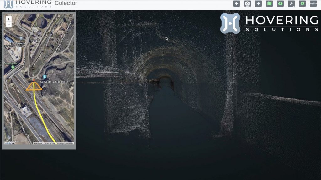
Geo-referenced colored 3D point clouds: they provide tridimensional data in absolute coordinates. Each of the millions of its points has a latitude, longitude and altitude units, in a similar way to other topographic data gathered by laser stations. Such information is relevant to estimate cross-sections shape forms, dimensions, volumes, deformations and fluid dynamic calculations.
High-resolution panoramic images: also georeferenced, they provide critical information not available in the point-cloud, which allows for a condition assessment of the surface and identify damages. Images are both simple and panoramic (180º FOV), the latter being more useful to perform an immersive inspection in the visualization tool, similar to walking across the tunnel as in Google Street View.
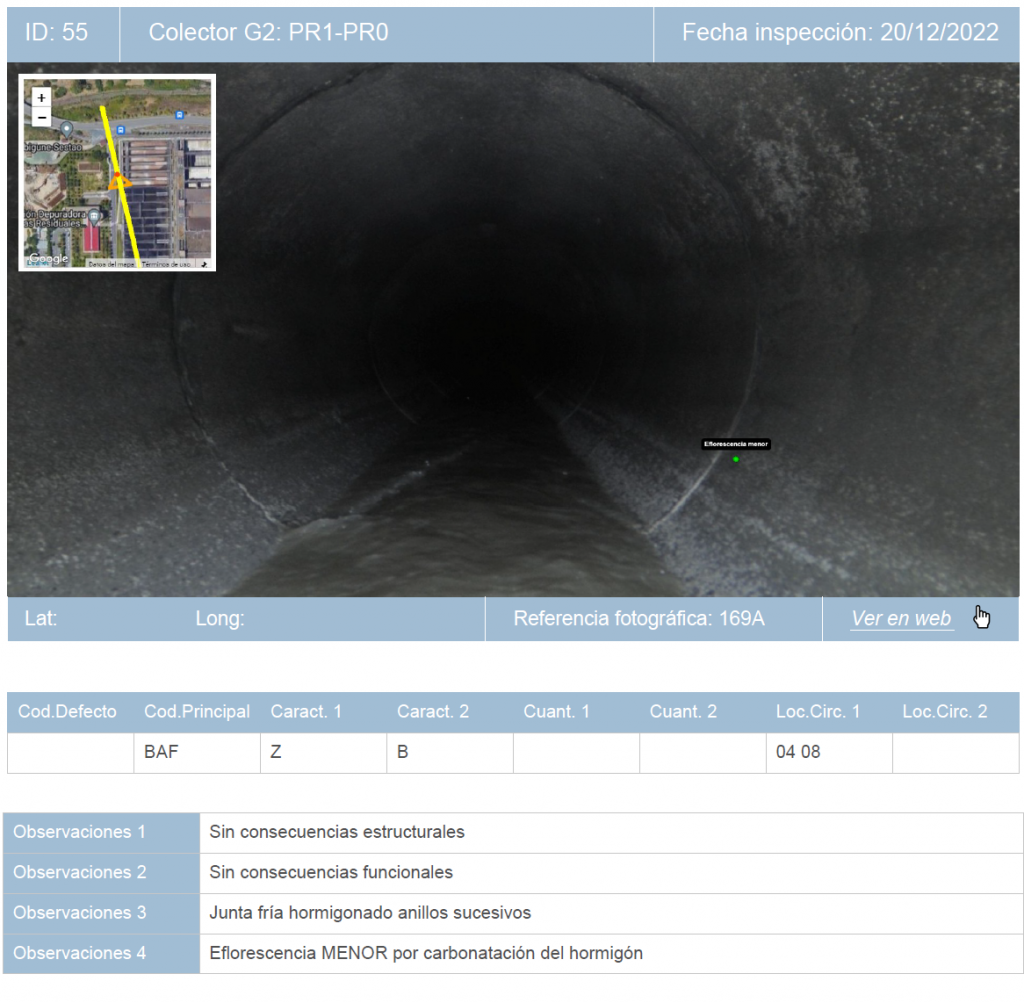
Damage report: a comprehensive document with all the damages found in the tunnel, classified and quantified according to standard civil engineering EU standars, makes it easier to process and synthesize the large amount of data resulting from an inspection.
Hovering Solutions also provides an online (web based) 3D visualization platform displaying both images and point clouds along with their absolute position on the map. This tool can be accessed from any device or operating system and is the most agile and flexible tool to visualize the data without requiring specific software to open the clumsy point cloud files (typically hundreds of MB-heavy). Output data format is standard and can be exported and accessed with standard point cloud software typically used by surveyors and engineers. Images have as well a standard format and can be viewed in any laptop or tablet, including the embedded georeferenced EXIF tags.
As in any other field where they have been applied, drones are transforming the way inspections are carried out, providing more accuratedata while improving safety. The technology is on the way to become a standard tool as urban areas transition into smart cities.
We serve cookies. If you think that's ok, just click "Accept all". You can also choose what kind of cookies you want by clicking "Settings".
Read our cookie policy