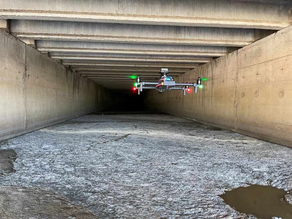
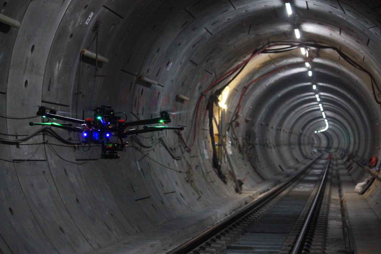
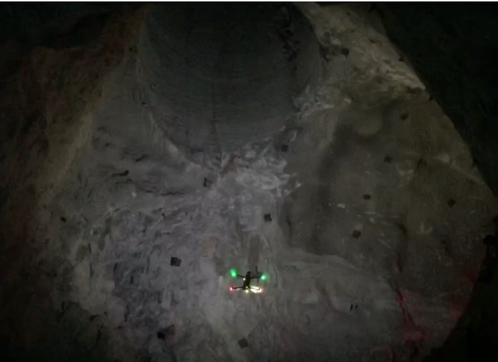
Fly underground with NO pilot, NO GPS(GNSS), NO radio communication and NO light Produce high detail 3D digital models of underground infrastructure: fast, accurate and SAFE
Mapping the cities most underground inaccesible areas in a safe and efficient way.
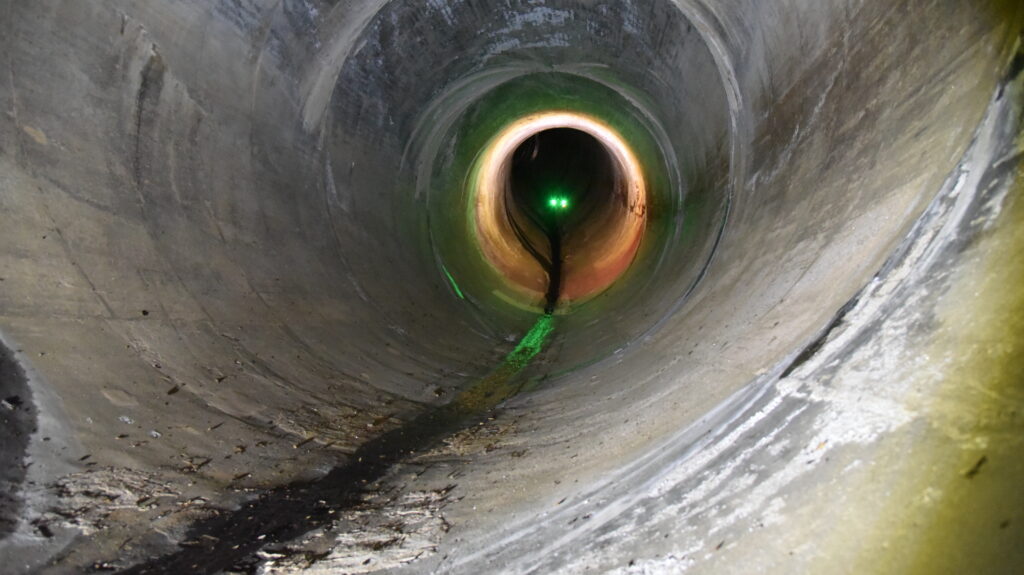
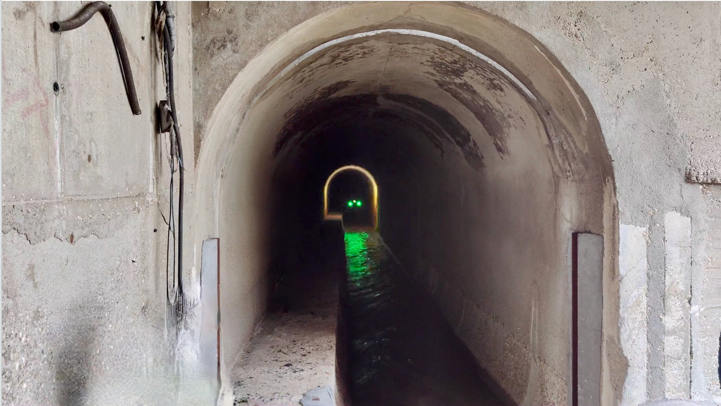
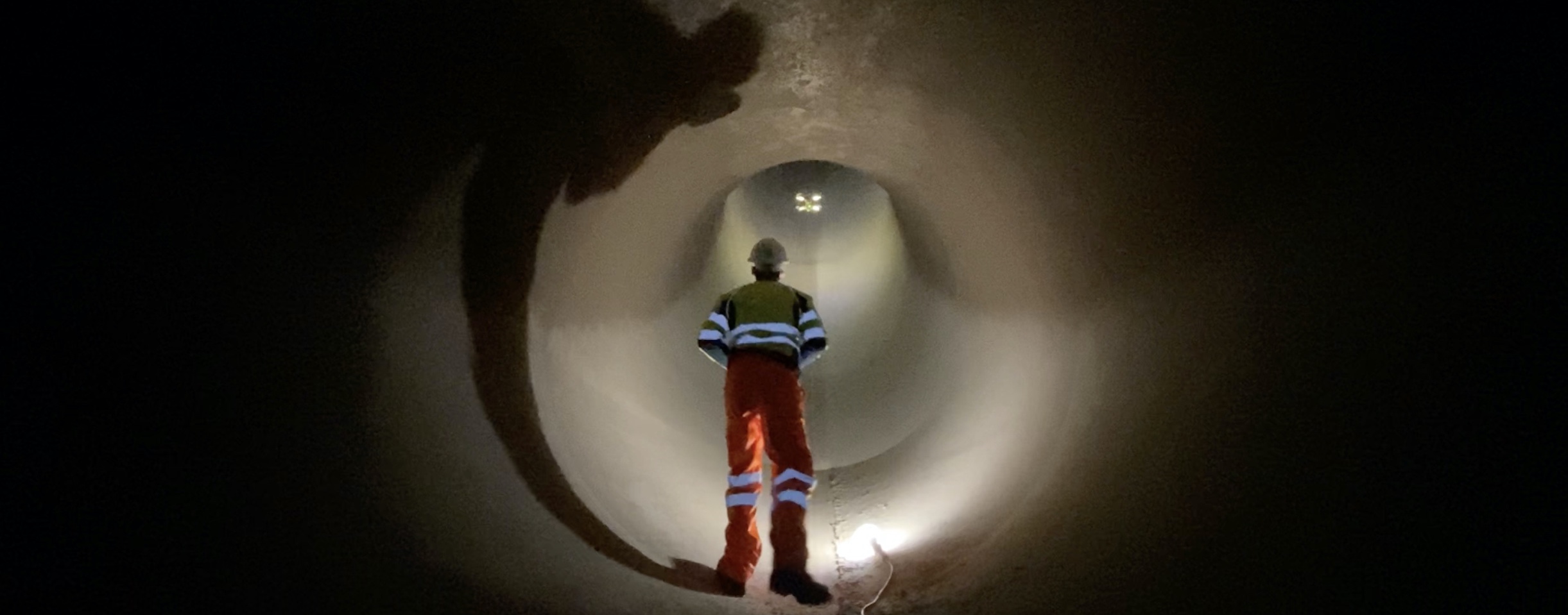
Our robots are able to fly fully autonomously from one location to another through sewage tunnels, providing geolocated data of the interior of the infrastructure, such as panoramic high-resolution images and georeferenced 3D point clouds.
Autonomous RISK-Free flight
Fly and capture data in risky underground areas in few minutes. Fly is fully autonomous, radio link with the robot can be lost. No pilot is needed.
Different missions options
Start mission at point A. Finish and recover the robot at either point A or point B depending on your needs or available accesses to areas to be scanned.
Cloud storage
Gathered data is uploaded by the robot to the cloud. Data is secured, classified and ready to be analysed.
3D online visualization
Check your data online. 3D models and high resolution panoramic images are ready to be analysed, shared and downloaded online. No special tools are needed. Just open your Web browser and check flight results.
Pay-as-you-go
Pay only for the amount of captured data. No CAPEX investment is needed.
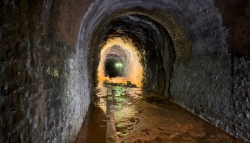
Water distribution networks are huge infrastructures of several thousands kilometres long. This critical infrastructure needs to be regularly inspected and maintained for it proper operation.
Hydro energy production involves the use a huge amount of underground pipes and water tunnels. The inspection of this critical infrastructure requieres time and the use of specially trained staff.
Penstocks are widely used in the hydropower industry around the world. This kind of pipes are used to carry water down from a water reservoir directly into the turbines to produce clean energy.
Our technology
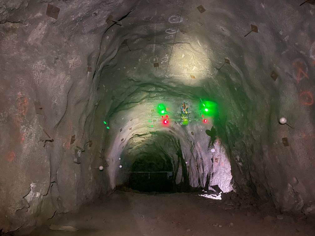
We solve the challenge of autonomous flight without GPS/GNSS, radio or any other communication
Our navigation system is being patented and is already bringing value to our customers, gathering data from restricted and hazardous underground sites where no other device can reach
We serve cookies. If you think that's ok, just click "Accept all". You can also choose what kind of cookies you want by clicking "Settings".
Read our cookie policy